Thursday 9 Jun 2011
SAT NAV TECHNOLOGY TO TARGET LEA VALLEY LEVEL CROSSING ‘HOTSPOTS’
- Region & Route:
- | Eastern: Anglia
- | Eastern
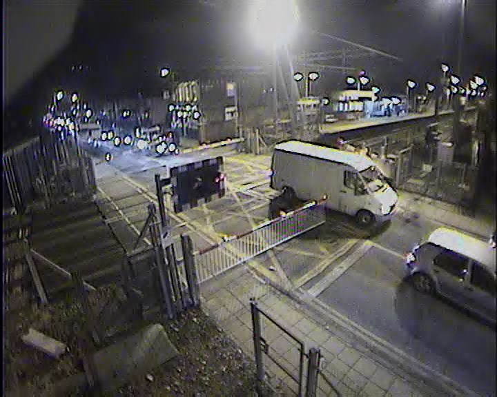
Motorists in the Lea Valley are set to benefit from a world first in sat nav technology, which will improve awareness of level crossings and encourage safer driving in a notorious ‘hotspot’ area for crossing misuse.
A free downloadable application which alerts drivers with a cheery train whistle that they are approaching a level crossing has been developed by Network Rail and leading satellite navigation provider Garmin.
It is hoped the new technology will encourage safer motoring and reduce the number of incidents which cause damage, disruption and deaths at level crossings each year.
Level crossings in the Lea Valley are some of the most misused in the county. More than a quarter of all reported incidents in 2011 at level crossings across Network Rail’s Anglia region* – which has more than 1,000 level crossings across six counties – took place at just five crossings in the Lea Valley.
- Enfield Lock, Enfield: 10 reported incidents since 1 January 2011, including two where the barriers were knocked off by vehicles trying to beat the lights
- Northumberland Park, Enfield: 10 incidents
- Highams Park, Waltham Forest: 8 incidents, including one where a youth’s bag was thrown over the barriers in front of an oncoming train
- Windmill Lane, Cheshunt: 5 incidents
- Brimsdown, Enfield: 5 incidents, including one which saw a woman with a pram caught inside barriers after trying to beat the lights
The new free application can be downloaded onto Garmin nüvi or nüLink sat navs from its website. Similar to choosing options that alert you to approaching speed cameras, the device whistles like a train and an ‘X’ appears on the screen with the name of the level crossing so motorists can approach and cross with care.
Network Rail and Garmin are also looking to develop an ‘intelligent’ version of the app, which allows motorists to set their journey to avoid level crossings. They also hope to develop an option which automatically alters motorists’ journeys to avoid crossings where the barriers are down for a significant period of time, if an alternative route is quicker.
Dyan Crowther, Network Rail director of operational services, said: "Motorists who jump the lights or smash into barriers as they try save time on their journey can cause great disruption and cost to the network, so we’re always looking at new ways to reduce the risk of incidents at level crossings.
"Sat nav technology has proved to be a great help to motorists in alerting them to what’s ahead on the road, so developing an app around level crossings seemed a smart idea. We hope it will be a useful aid to motorists as our roads and railways get even busier."
Anthony Chmarny, Garmin head of communications, said: "The development of this free level crossing application shows the ongoing commitment we have to ensure our sat nav customers have the very best travel information at the tip of their fingers. We believe this will help to save time, money and most importantly improve drivers’ safety during their journey."
Chief Superintendent Eamonn Carroll (Territorial Policing) British Transport Police said: “This innovative sat nav technology will be a useful additional tool in helping reduce level crossing misuse across the country. Our officers remain committed to not only detecting offenders but working closely with Network Rail to reinforce the safety message and continue our educational approach, in order to change driver behaviour."
More technology
Another of Network Rail’s recent technology-driven deterrents to reduce incidents, its purpose-built marked police van equipped with license plate recognition camera technology, has lifted the lid on the scale of the problem in the south of England.
In three months in operation, British Transport Police officers, who operate the van, have caught and prosecuted 1,131 people, despite the van having a very visible presence close to the crossings to act as a deterrent.
In addition, these incidents have been recorded across Britain (January to 30 April 2011):
- 31 near misses, where vehicles have narrowly avoided being struck by a train
- 77 near misses with pedestrians, who were lucky not to lose their lives
- 58 incidents where vehicles have struck crossing barriers – including two vehicles which were also struck by trains
- One person has died at a level crossing this year (excluding suicides).
Commenting on this, Dyan Crowther added: "The camera van has proved what we always believed – that far too many people are misusing level crossings, which has to stop. It’s a little too early to see a confirmed trend but we have seen initial reductions at some crossings, which is encouraging.
“Our aim is to improve safety not get prosecutions. We hope those caught will change their behaviour and this along with other activities we’re running we can see a reduced impact on passenger services and the cost of these crimes on the running of the railway."
International Level Crossing Awareness Day, 9 June
Network Rail is supporting British Transport Police at safety awareness events at Enfield Lock and Northumberland Park crossings today (Thursday 9 June).
Notes to editors
*The Anglia region refers to the railway lines which run in and out of London Liverpool Street and London Fenchurch Street stations and their many branch lines. This means Essex, Suffolk, Norfolk, Cambridgeshire and parts of Hertfordshire and Greater London.
About Garmin
The global leader in satellite navigation, Garmin Ltd. and its subsidiaries have designed, manufactured, marketed and sold navigation, communication and information devices and applications since 1989 – most of which are enabled by GPS technology. Garmin’s products serve automotive, mobile, wireless, outdoor recreation, marine, aviation, and OEM applications. Garmin Ltd. is incorporated in Switzerland, and its principal subsidiaries are located in the United States, Taiwan and the United Kingdom. For more information visit Garmin's media centre at http://garmin.blogs.com/ukpr. Garmin is a registered trademark of Garmin Ltd. or its subsidiaries. All other brands, product names, company names, trademarks and service marks are the properties of their respective owners. All rights reserved.
About Network Rail
We own, operate and develop Britain's railway infrastructure; that's 20,000 miles of track, 30,000 bridges, tunnels and viaducts and the thousands of signals, level crossings and stations. We run 20 of the UK's largest stations while all the others, over 2,500, are run by the country's train operating companies.
Usually, there are almost five million journeys made in the UK and over 600 freight trains run on the network. People depend on Britain's railway for their daily commute, to visit friends and loved ones and to get them home safe every day. Our role is to deliver a safe and reliable railway, so we carefully manage and deliver thousands of projects every year that form part of the multi-billion pound Railway Upgrade Plan, to grow and expand the nation's railway network to respond to the tremendous growth and demand the railway has experienced - a doubling of passenger journeys over the past 20 years.
Follow us on Twitter: @networkrail
Visit our online newsroom: www.networkrailmediacentre.co.uk